Wednesday, February 10, 2010

AN EVENING AT BUKIT BROGA, SEMENYIH

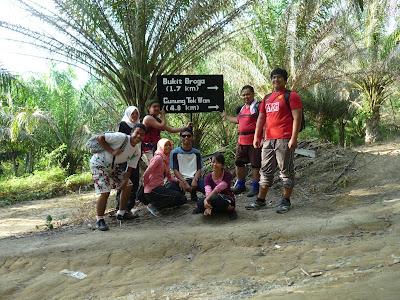
After conquering Bukit Tabur in the afternoon and after having our late lunch at Tmn Melati, we were thinking of conquering Bukit Broga. On the way to Semenyih, it rained very heavily. so, we cancelled the plan. However, the weather became clear just before the Semenyih exit, so we decided to proceed. It's already 5.30pm.

Bukit Broga is situated at Semenyih. If you from Kajang Silk highway, just follow Semenyih signboard and after that just follow Broga direction. Just a few hundreds meter from Nottingham University (Malaysia Campus) you can see a palm tree car park on your left. During normal time they will charge you RM2 to park your car there.


We were lucky...no parking charge
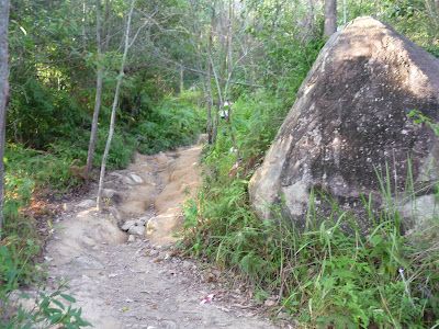
The hiking started at the palm oil plantation. The whole hiking doesn't need much stamina except a little. We managed to reach the summit for about 30-45 minutes.


Not very far...just do it slowly...no need to rush


Pictures taken along the way:


Feels like somewhere in New Zealand or...

Resting place...I think at checkpoint 2

On top of the world

To the final checkpoint
At the top...2 peaks in one day
Conclusion:
Bukit Broga is not too heavy even for those who do not have stamina. Just do it slowly if you are not rushing.
I think we get a better view if we do it in the early morning which most of the people are doing. Moreover, it gets very hot along the way and at the top in the afternoon since there's no shade above there.
Good for morning exercise/jogging. Good for family outing as well. Nice view. But if you are travelling from a distant just to summit Bukit Broga...I think it might be a little bit not worth it. Luckily, we did it after summitting Bukit Tabur and we didn't spend much time above there since it gets dark pretty quickly.

Tuesday, February 9, 2010

BUKIT TABUR WEST ADVENTURE

Salam,


Haha..another series of the "Underestimate" adventure.

Last Saturday, 6/2/2010, we had a day trip to Bukit Tabur. At first, only 4 of us confirmed to go but eventually it became 9.

Bukit Tabur is located at Taman Melawati, KL and next to Klang Gate Dam. Bukit Tabur ridge is rated the longest Quartz-Rich Ridge in the worlds...really???

7.30am - Departed from MMU Melaka
9.00am - Had breakfast at Seremban R&R

10.00am - Headed straight to Taman Melawati. The traffic was a bit congested a MRR2. Took the Melawati Exit and went straight. At the first roundabout, take 9 oclock direction. Second roundabout, take 12 o'clock direction until you find a T junction, turn right and go straight until you reach Klang Gate Dam. The entry point to the trek is on your left just before the Dam.


The green gate infront is the entrance to the Klang Gate Dam
Park your car along the road
11.00am - Start hiking. The weather was very hot. The hiking supposed to be done in the early morning.

The view was very nice. Could see the lake from above. A lot of interesting rock formation.

After about an hour hike, I think at checkpoint 8, we met a rescue team from DBKL doing their training there...quite a number of them with complete equipment. Here, begins our first 90 degree rock climbing. I thought it was the first and the last and the peak is just right after the steep slope...but...pheww..very bad guess. Some of the "underestimates"refused to continue after seeing such slope. I proceed with the expectation that there'll be no more climbing like that afterwards and that's it...I will get back to them and we'll go back together using the same route we went up. However, one of the rescue team told us that it's nearer to go down if we proceed and they will cover us. With this assurance all of us agreed to proceed...and the adventure begins. There were a few more slopes like this infront.


After a few ups and downs, we finally managed to reach the end. Thanks to the sporting abang rescue that had helped us to finish the climb. The view up there was superb. We can see KL and UIA from up there. There's a lot of interesting and strange looking plants and trees. Some parts of the trek were mossy and very picturesque.

Conclusion:

Bukit Tabur is very challenging and risky for those who are not well-prepared mentally and physically. It involves hiking and rock climbing. Although the hiking is not really tiring, but the rock climbing could be fatal to those who are not careful enough. My advice, if you are afraid of height, DON'T GO, because a lot of the steep climbings require you to use your bare hand...no rope is provided.

Bukit Tabur has a good package:

- HIKING

- ROCK CLIMBING


- LAKE VIEW

- CITY VIEW


- INTERESTING PLANTS AND TREES

- INTERESTING ROCK FORMATION


- MOSSY FOREST


If the temperature up there is cold, it completes the package...Bukit Tabur would be a magnificient place to go.

As a whole, the trip was successful with the help and confidence given by the DBKL rescue team. Otherwise, I think most of us will not have the guts continue the hiking...thanks again.


Thank you bro..

My advice:

The route can also be quite confusing. You might end up not completing the whole trekking if nobody guides you since there is no proper signboard available along the trek.
Start your hiking in the early morning for better view and temperature.

Bring enough water and food..haha

Thank you.

Wednesday, February 3, 2010

DIVING TRIP TO SIPADAN, MABUL AND KAPALAI ISLAND

DIVE AT SIPADAN, MABUL & KAPALAI
Assalamualaikum wbt,

Diving has always been a pleasure to me. It's been a while since my last dive at Redang Island last June 2009. This time we plan to dive at Sipadan Island. As described by Jacques Cousteau, a well-known oceanographer, Sipadan is an untouched piece of art, and it is the only oceanic island of Malaysia. It is located in Semporna, Sabah.

For this trip, we did quite a late planning and booking...i.e. three month before the actual date. After searching on the internet, we finally agreed to choose Billabong Scuba for its reasonably low price. Later on, from our conversation with those who had frequented there, they told us Billabong is the cheapest operator so far...so I think we made a wise decision.

Our flight is from LCCT to Tawau using Air Asia. There's only four of us in this trip i.e. Azmir, Fadh, Achap and myself. Below are the chronological events of our trip to Sipadan.

20/1/2010

7.20am - Flight to Tawau from LCCT. We spent the night at LCCT in order not to miss the flight. Thanks to Hazimin and Mansur who were willing to send us to LCCT from Cyberjaya. Flight to Tawau took around 2hrs and 45minute.

10.00am - Arrived at Tawau airport. Took a van to Semporna for RM20 per person. However, for comfort, we advise you to arrange with your dive centre to arrange the transport from airport to Semporna during your arival and Semporna to Tawau for a little bit higher charge. Semporna is about 1 hour drive from Tawau.

11.30am - Arrived at Semporna and went straight to Billabong. At first, we planned to stay at Semporna for one night before going to Mabul Island the next day. After seeing there is nothing much we can do at Semporna Town we changed our mind and decided to go straight to Mabul.

At Billabong office, Semporna

1.00pm - Took a boat to Mabul Island. The boat was speeding like crazy...luckily we were safe. Mabul Island is about one hour boat ride from Semporna Jetty.


From Semporna to Mabul Island by a speedy boat


2.00pm - Arrive at the Billabong homestay at Mabul Island. After we got our room, we took some rest and we went snorkeling around the island. For your info, there's no electric supply during daytime at the homestay...so it's hard to sleep in the room during daytime.


Billabong Homestay at Mabul Island
Sipadan Island from Mabul Island


21/1/2010

3 dives today at Kapalai (1) & Mabul (2). Mabul and Kapalai is just nearby. Famous for muck-diving. If you enjoy observing little and tiny creatures underwater, Mabul and Kapalai are suitable for you. However, we saw a lot of turtles.

Preparing for dive

22/1/2010


All divers need to register here (Jetty) before diving at Sipadan..Drop-off point is just a few metre from this jetty

3 Dives at Sipadan Island. Sipadan is 45min-1hr boat ride from Mabul Island. We were very excited for the dive. Our first dive site was Barracuda Point. During our first descent, we were welcome by a school of jacks. At first, the visibility was not very clear. For me, Barracuda point is very beautiful with a lot of turtles and white tip sharks. There were plenty of colourful fishes down there as if you are diving inside an aquarium. I rated this dive site 5-star. However, we didn't see any barracudas here.
Taking rest at Sipadan Island after each dive

The other two dives were wall dives at Southpoint and Whitetip Avenue. However the current was quite strong and the visibility was not very good. Since the current is quite strong here, it's very important to have a good buoyancy in order to dive in Sipadan.

We only had the chance to see school of barracudas during our third dive. There were thousands of them. As I was very much engrossed looking at the barracudas, I didn't realise that all my friends and divemaster had left me. I only realised when I look at my back and didn't see anybody. I was left alone and slowly swim but still enjoying the view of the barracudas which were just infront of my eyes. After swimming for about 30 meter. I finally decided to ascend. After the ascent, I saw all of the had boarded the boat about 100 meter from my ascent point.

23/1/2010
Last day dive at Sipadan Island
Dive sites at Sipadan Island...we managed to dive at 6 different sites


Another 3 dives at Sipadan i.e. Midreef, Drop-off point and Hanging Garden.
The best dive is at Drop-off point where we ascend at a point where it is over 600m deep. Drop-off point was awarded the "Best Beach Dive" in the world. During this dive, we passed through the mouth of Turtle Tomb cave where we could see a school of jacks at the ceiling of the cave.

During the ascent of our third (last) dive, we were again entertained with a school of jacks as if they were bidding us farewell.

Conclusion.

As a whole, I amvery satisfied with my dives in Sipadan. Undoubtedly, Sipadan is bestowed with bounties of diversified multi-coloured underwater marine creatures which should be preserved for our next generation. Here, turtles and white-tip shark can be found in abundance. For me, I really enjoyed the dive experience here especially the 'lost' incident and the view of school of jacks and barracudas infront of my eyes. Hope to dive again in Sipadan.

Sunday, January 3, 2010

ENDAU ROMPIN (SELAI) NATIONAL PARK, JOHOR

ENDAU ROMPIN (SELAI) NATIONAL PARK EXPLORATION

Last week, from 30th December 2009 until 1st January 2010, I and a group of MMU Melaka Rakan Muda went to Endau Rompin (Selai) National Park. This is my second time, the first was back in 2002/3. I've also been to Endau Rompin (Peta) National Park before.


From Melaka, we took the PLUS highway and exited at Yong Peng and headed towards Labis. Before reaching Labis, you'll find the junction to the National Park on your right. This route is rather far compared to if we exited at Tangkak and head to Labis.


At Bekok, we stopped and parked our vehicle at the National Park office for registration and transit to 4WD. We need to use 4WD as the road is not suitable for normal vehicle. The 4WD fare is RM200 for a return journey. Here, we can get information on activities that can be done inside. We were also advised to get some chocolates and ration from the nearby shop. We were also provided with 2 guides. From the office, it took 1- 1 1/2 hour to go inside. However, there have been much improvement on the road leading towards the National Park as compared to when I went there in 2002/3.
Just arrived at Lubuk Merekek using 4WD

Our campsite is at Lubuk Merekek which is very conducive with proper facilities such as toilet, surau, BBQ area and dining hall and most importantly it is just next to the river where we can swim. However, starting from July 2009, visitors are not allowed to fish here.

Campsite at Lubuk Merekek

River just infront of the campsite at Lubuk Merekek where we can swim

Among the activities;

1. Trekking to Takah Tinggi, Takah Berangin and Takah Pandan. This can be done in a day provided we have enough stamina. The trekking was done along the beautiful river and stream. However, we only managed to go to Takah Tinggi and Takah Pandan due to some unforeseen circumstances. The waterfalls are magnificiently beautiful and I enjoyed it so much.
At Takah Tinggi

At Takah Pandan, very nice view and breezing temperature

2. Serampang Ikan

This has to be done at night while fishes are asleep.

Just a model to show how to serampang ikan...haha

3. Water tubing.

Water tubing at Lubuk Tapah

This activity is done at Lubuk Tapah. Rental of the tube is RM 7 per piece and can be shared.

My conclusions about Endau Rompin (Selai) National Park are:

1. Very nice view.


2. Great waterfalls.

3. Good place for swimming.


4. Great camping facilities.

A proper surau

A proper toilet and shower

5. Affordable.

6. Friendly guide.
7. You'll get certificate.


Certificate to all visitor...but make sure you provide the correct spelling of your name


My advice:

1. Make sure you have good stamina for trekking.

2. Bring some chocolate or energy bar during trekking

3. Please conserve the nature including no fishing and no tree cutting and please recycle.

4. Don't swim at forbidden areas. If you're not a good swimmer be careful not to swim at deep areas.


My hope:

1. Control development that can damage the nature and its beauty.


Thank you.

Sunday, December 13, 2009

HIKING MT. BRINCHANG, CAMERON HIGHLAND

MT. BRINCHANG

This is my second time to summit Mt. Brinchang. The first time was via the road but this time through Trek 1. It is 2032m above sea level. The hiking started early at 8.30 am. We all gathered at Brinchang town infront of the Police Station to wait for the guide from the Forestry Department. The cost of a guide for a single hike to Mt. Brinchang is RM250. At first, I thought it was worth it. Later on, I found out that it was a bit overpriced for the effort that the guide has to put for that hiking.

Before trekking...gather infront of Police Station, at Brinchang town

Unfortunately, it was raining on that day and we thought it's going to stop later. However, the rain continued for the whole day. Anyway, all of us were reminded to bring along poncho for standby which most of us did. Some did not.

Our planning was to trek the mountain through Trek 1 which begins at the army quarter & Jabatan Bekalan Air at Brinchang Town and trek down via the road to Sg. Palas tea plantation.

The trek condition was muddy and very slippery but it was not too tough as I imagined. Just need a little bit of stamina. The view at an earlier stage was just normal but to the last stage before reaching the summit it become a little bit mossy( but not as mossy as Mt. Irau). The last group reached the summit after 3 hours hiking.


The last group to reach the summit.

The rain and wind made the temperature freezing at the summit and we could not stay long up there. We continued to trek down via the road. It was 12 km and from the summit to Sg Palas.

On the way down

On the way down to Sg. Palas tea plantation

Overall, the trip was very successful. Most of us enjoyed the hiking. For me, it is not too hard even for beginners. The only thing that made the hiking a little bit hard was the fact that it was raining that day and it was freezing cold. Moreover, some of us who did not have poncho suffered severe cold during the trekking. Otherwise, the trekking must be wonderful. So for Mt. Brinchang hike it is highly advisable that:

1. Wear a simple rubber shoe for trekking.

2. Don't go during raining season

3. Bring an emergency poncho.

4. If got time, spend a night up there before going down. I haven't done this.